Introduction
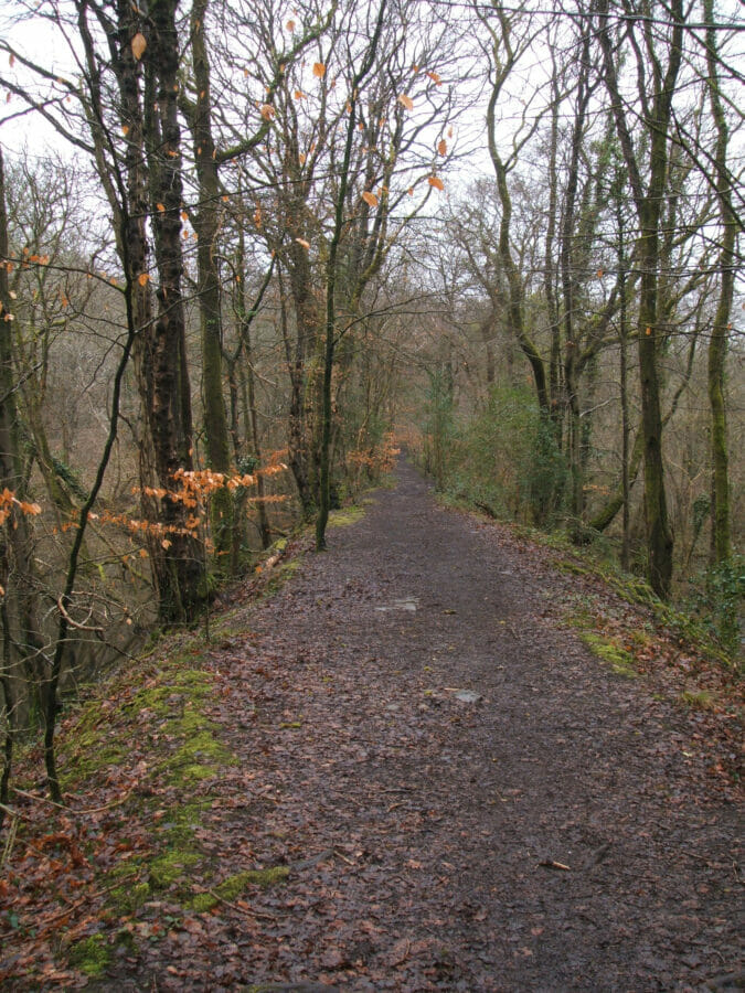
Philip Richard started to develop Rhydydefaid No 2 slant, later known as Commercial, in the late 1880s; it lay about 700 yards to the north-east of the abandoned Rhydydefaid No 1 pit. Production started in 1891 or at the latest 1892; A railway connection to the new slant was put in from the existing siding off the London & North Western Railway which had been installed to serve Rhydydefaid No 1. The railway is shown on the 2nd edition of the Ordnance Survey 6 inch map (revised 1896) and it is safe to assume that it was in existence by the time the colliery opened. It still forms a very prominent feature within Clyne Woods.
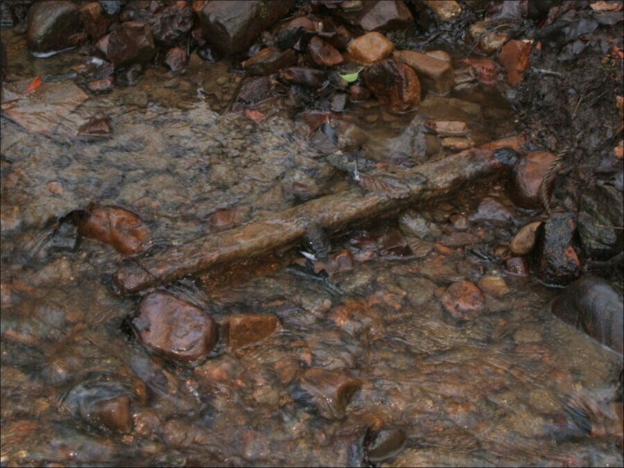
The Commercial Colliery siding ran on an embankment in a straight line for most of its length from the end of the earlier Rhydydefaid No 1 siding to a point just south of the bridleway from the present-day Rhydydefaid Drive to Killay where it adopted a new alignment, crossed the bridleway and entered the colliery. Immediately to the south of the bridleway and on the north-west side of the railway there are remains of a building which can best be interpreted as a weigh house to weigh the outgoing coal. Scattered pantile fragments are probably from the roof of the building; the word bridgewater, the place of manufacture, can be seen impressed on some of them. On the north side of the bridleway where it is crossed by the railway a rail can still be seen embedded in the side of a drainage ditch; another can be seen in the middle of the bridleway itself. A little to the east of this point a length of light-weight bridge-rail (of a type that would have been used underground) is fixed across the same ditch. The formation of the railway can be followed, although much overgrown, to the north of this point and alongside a wall that probably formed a tipping stage or retaining wall. Cartographic evidence suggests that this was the limit of the standard-gauge track.
After the colliery closed in 1908 the railway ceased to serve any purpose, although the track is still shown as in situ on the 1919 revision of 25 inch Ordnance Survey plan. Subsequently, a platform composed mainly of waste bricks was built over the embankment at its south end in connection with the erection of new brick kilns in the inter-war years. After the slant had closed what appears to have been a clay pit was opened out to the west of the spoil heaps. If this is so, then the clay must have been carried to the brickworks along the embankment but it is not known whether the railway track remained in use for this purpose or if the surface of the embankment was used as a convenient track for road vehicles. The frequent patching with waste bricks to be seen along the embankment probably represents repairs carried out by the owners of the brickworks during this phase.
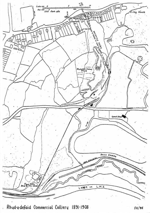
(Copied by the late John Hayman from the 1919 revision of the 25in Ordnance Survey plan)